Map Projections
Maps And Directions > History of Maps • Map Projections
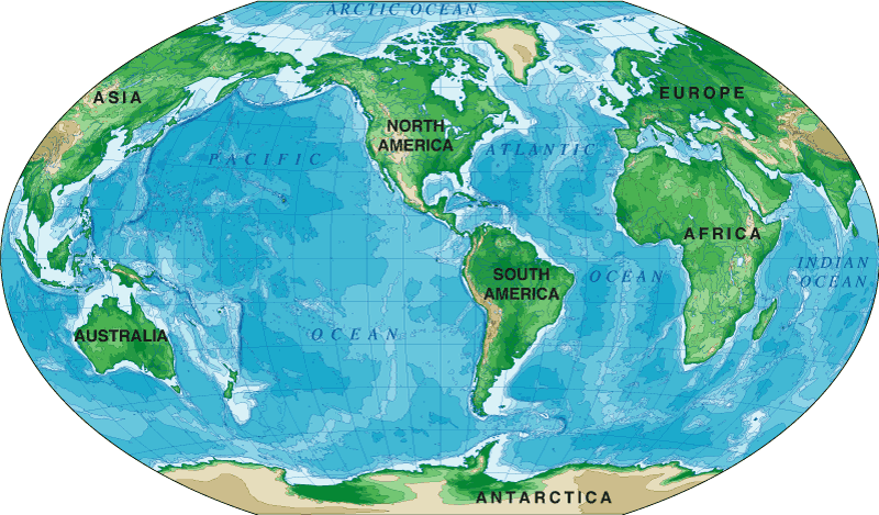
Cylindrical Projections
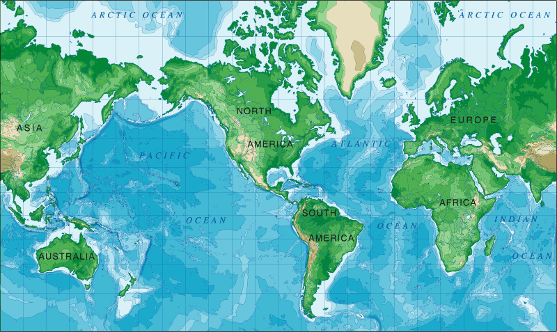
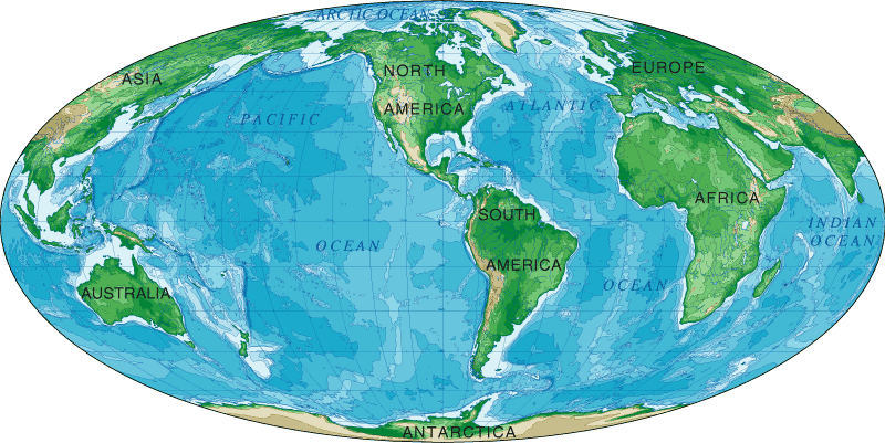
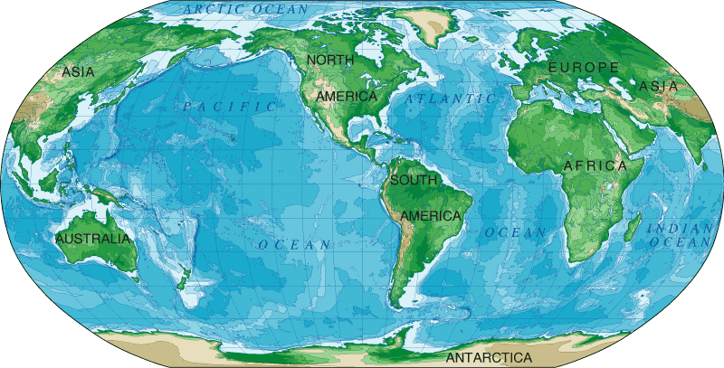
Cylindrical projection maps, in which a cylinder which is wrapped around the Earth at the Equator, are often used for complete world maps. On a cylindrical projection map, the longitude and latitude lines are straight. The Mercator, Mollweide, and Robinson world maps shown below illustrate three popular cylindrical map projections.
Mercator Projection
The Mercator projection, designed by Flemish cartographer Gerardus Mercator in 1569, is a cylindrical projection which preserves local angles, and in which the east-west scale is identical to the north-south scale at every point on the map. It became widely used for nautical maps and navigation charts on which navigators could plot straight line courses. However, the Mercator projection exaggerates the size of high latitude areas such as Greenland and Antarctica.
Mollweide Projection
The Mollweide projection, also known as the elliptical projection, sacrifices accurate angles and shapes in favor of accurate area representations. It was first published by Karl Mollweide, a German astronomer and mathematician, in 1805. Mollweide is a pseudocylindrical projection which was designed to improve upon the Mercator projection.
Robinson Projection
The Robinson projection is a pseudo-cylindrical projection designed for Rand McNally by Arthur Robinson in 1963. Lengths of parallels, pole lines, and the central meridian are arbitrarily calculated for best visual appearance. First published in 1974, it was adopted for world maps by the National Geographic Society in 1988, but abandoned in favor of the Winkel Tripel projection in 1998.
Perspective Cylindrical Projections
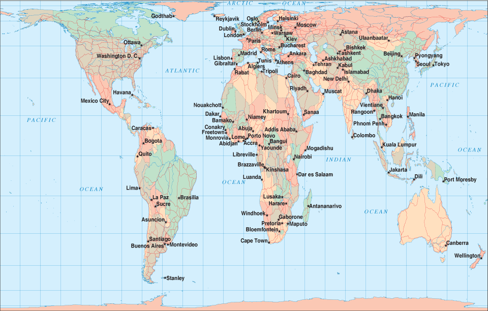
Johann Lambert's equal-area projection features standard parallels at the Equator while James Gall's orthographic projection features standard parallels at 45 degrees North and 45 degrees South. Below is a Gall's projection world map showing the world's oceans and continents.
Azimuthal (Planar) Projections
Azimuthal projection maps, in which the Earth's surface is projected onto a flat surface placed against the globe, are most often used to map polar regions, but may be used to represent any part of Earth's surface. The imaginary perspective point used to project the Earth's surface onto the plane may be located in the center of the Earth (Gnomonic projection), on the opposite surface of the Earth (Stereographic projection), or at an infinite distance from the opposite side of the Earth (Orthographic projection). The Winkel Tripel world map shown below illustrates a popular azimuthal map projection.
Winkel Tripel Projection
The Winkel Tripel projection is a modified azimuthal projection, designed by Oswald Winkel in 1921 and adopted by the National Geographic Society in 1998. Based on the arithmetic mean of the Aitoff projection and the ancient equirectangular projection, it offers a pleasing visual balance between shape and scale distortion.
Conical Projections
Conical projection maps, in which the Earth's surface is projected onto a cone placed on the globe with its point over one of the Earth's poles, poles, are best suited for maps of polar and mid-latitude regions. They are often used for aeronautical charts as well.
Copyright 2007-2026 Zeducorp.
All rights reserved.
Maps And Directions • us is a Chosen Sites™ information resource.
All rights reserved.
Maps And Directions • us is a Chosen Sites™ information resource.
Map Projections
Related Image |
 North America Map
|